Roundway Hill and covert, Oliver's castle and Millennium White Horse
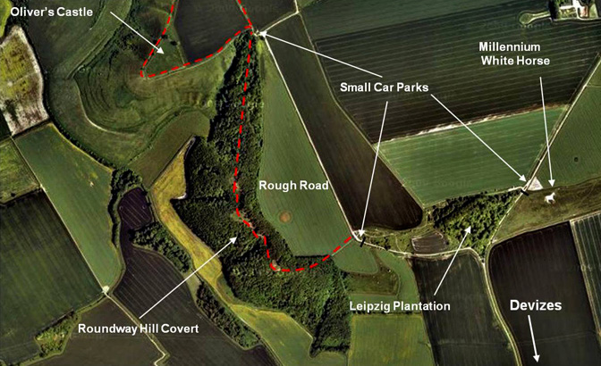
Devizes is set on a high plateau, 120 to 130 m high - amongst the Wessex Downs. To the north of Devizes lies Roundway Hill and Down, and Oliver's Castle. These form part of the North Wessex Downs Area of Outstanding Natural Beauty. The map below that shows the location of Oliver's Castle (right), Roundway Hill covert, the Leipzig plantation and the Roundway Millennium White Horse Photogallery.
In 1643 during the first English Civil War there was an important battle on Roundway Hill. The Battle of Roundway Down is reported as a Devizes Heritage page.
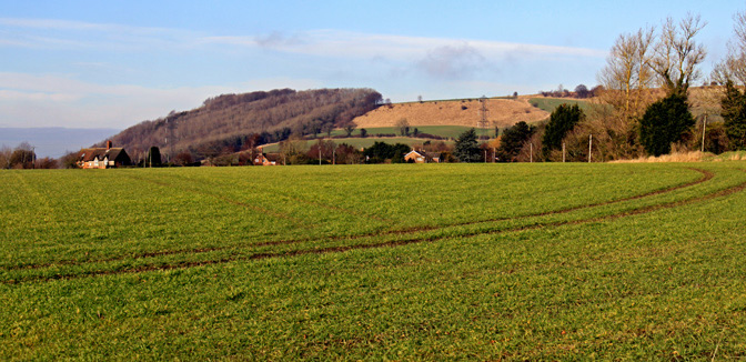
Below is Roundway Hill with Roundway covert on the right and Oliver's castle right of centre. The gullies down which Parliamentary cavalry met their deaths are to the left of Oliver's castle.
Access to these sites is from the London Road out of Devizes. Turn north at the Travelodge Hotel towards Roundway village. After about a mile turn right onto a tarmac road that has a no through sign on it. At the current time there is no sign to Roundway Hill or Oliver's castle. After about half a mile you are on the road shown on the map below. As you go up the hill there is a fork in the road. Turn right for the Leipzig plantation and the White Horse car park. Turn left for the Roundway Hill covert and Oliver's castle.The black lines on the access roads indicates the end of the tarmac and the red dashed lines indicate good footpaths.
Oliver's castle - an iron age hill fort Oliver's castle is an iron age hill fort; it is in Bromham parish and would be more properly called Bromham hill fort. The name Oliver is associated with the Battle of Roundway when Sir Willam Waller's 2500 cavalry (horse) camped nearby for three nights. Over time, as is common throughout England, anything Civil War is linked to Oliver Cromwell who almost certainly never went there!
Olivers Castle is an Iron Age hillfort, dating probably from about 600 BC. Bronze age, iron age and romano-british finds have been also been made here. It has a very distinctive triangular plan. It is defended by a single bank and ditch enclosing an area of about four acres, relatively small for an Iron Age fortification. The site sits at the west end of the Vale of Pewsey with a commanding view across the flat plain stretching westwards from Devizes.The hillfort is one of a series defending the northern chalk scarp running acros 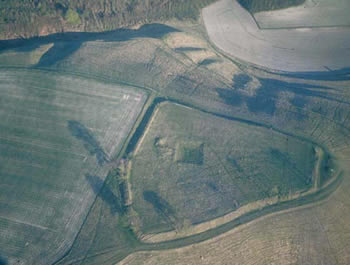
s Wiltshire. Others in the sequence include Oldbury Castle near Calne, Barbury Castle and Liddington Camp near Swindon.The square feature inside the camp visible on the aerial photograph is a 19th century dewpond.
Right An aerial photo of Olivers castle withe right light to show up the old iron age features. Poto courtesy of the Wiltshire History Centre in Chippenham
There is a separate report on the archaeology and history of the Oliver's castle .
A)Bowl barrow excavated by BH and ME Cunnington who found primary cremation, fragments of incense cup, bone button plus 3 plain coarse urns in a secondary position to S. B)Excavated by C Gingell,1977, who found a secondary cremation in an upright urn.
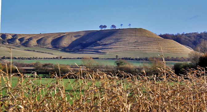
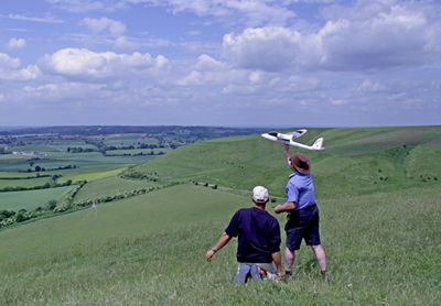
It has a distinctive profile from the east, west and south. It has five prominent trees set on its high brow and one can see why iron age people used it as a fort. It is a wonderful place to stroll through high chalk grasslands and to picnic or fly kites. Left Neil Maw launches his electric plane with a camera on board. Neil and Ray Kyte are helping Devizes Heritage do an aerial survey with a still and video camera of the Battle of Roundway site.
Access is as described above, the last half mile is on a slightly rough road, but the car park is better than that for the Covert. From the car park a short circular walk of about a mile, as partially indicated on the map below, gives wonderful views.
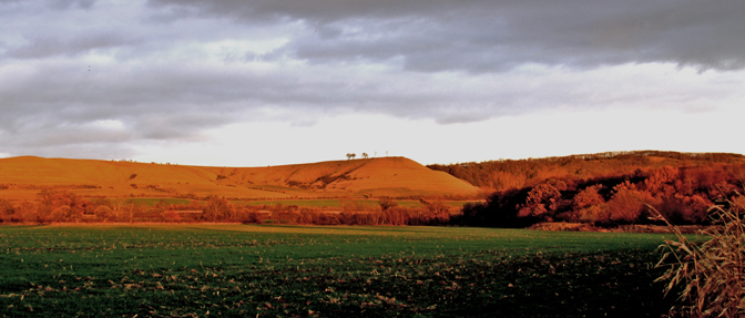
Below is a view of Oliver's castle from Bromham. The photo was taken 30 minutes before a very yellow sunset.
Oliver's Castle played a critical role in a major Civil War Batle in which the Royalists gained their best Cavalry victory. Some of the parliamentary cavalry were fleeing the battle, hotly pursued by the Royalists, and they died when they fell down the steep slopes of Oliver's Castle and many were killed. The Battle of Roundway Down 1643 is reported as a Devizes Heritage page.
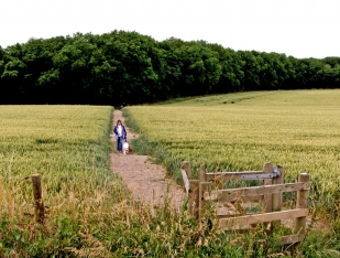
Roundway Hill Covert and Oliver's Castle Above is a telephoto shot of Roundway Covert taken from the Tower of St. James Church by the Crammmer Pond in Devizes The Covert is a 68 acre wooded area with 3 open grass areas that provides unique walk of about 1 mile on Roundway Hill. The wood is broad leaf, originally beech but now mostly of ash, and it is provided with 2 benches in open grass sections. The walk starts from the small car park at the end of tarmac road. There is an obvious gate and good footpath across the cornfield into the woods. Bear right after entering the wood and after a few hundred metres bear left on the path that leads through to the open areas seen on the aerial photo below. The path leads to the Oliver's castle car park. An alternative is to turn back from the 2nd bench to the car park through the woods. Below left is a photo of the path, one of the open areas and a bench. There are also photos of the wood in the photo gallery .
Natural History of Roundway Covert
Within
the Covert woods are sunny, grassy areas where chalk-loving plants grow
and a wide variety of insects, including butterflies, grasshoppers and
bees, can be found.From seats provided along the mile-long trail there
are panoramic views extending from the Vale of Pewsey to the east, along
the northern edge of Salisbury Plain to the Avon valley and the
woodlands of the Bowood and Spye Park estates to the north. In
spring the open grassy slope is yellow with horseshoe vetch
flowers. The leaves of this plant are the only food of the caterpillars
of the chalkhill and Adonis blue butterflies. The patches of very short
grass are grazed by rabbits, and the only plants that grow here are
small ones like hairy violet, and those that rabbits will not eat, such
as Carlin thistles, with their prickly leaves. The flowers persist
through the winter. From June until the end of August large
numbers of the marbled white and the dark-coloured ringlet
butterflies can be observed. Grasshoppers are at their noisiest then and
lizards sun themselves on the path.
On the right is a photo of the path to the Covert in the background,. the photo is taken from the end of the tarred road shown on the map. The original chalk scrub and downlandwas grazed by sheep. Planted as a beech wood, it was felled when it reached maturity. In the early 1950s, the area was replanted with beech but much of this replanting failed. Rabbit grazing has helped to create and maintain some of the clearings.The covert was subsequently leased to the Forestry Commission by the Society of Merchant Venturers, as Trustees of the St Monica Trust and more work was done towards re-establishing the wood. Devizes School and Wiltshire Wildlife Conservation Volunteers have built and maintained the path andplanted areas withsaplings, with the help of volunteer groups such as the Devizes Air Training Corps. Wiltshire Wildlife Trust took on the management of the trail and glades under a Conservation Licence until recently.
Below: Roundway Covert (on left ) and Roundway Hill (centre) above Roundway village. |
The Devizes Millennium White Horse.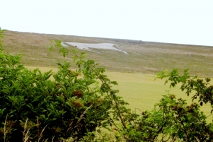
The Devizes Millenium White Horse was conceived in 1998 and constructed in 1999.
It was designed by the late Peter Greedy and is maintained by a group of volunteers called the "Cavaliers of the Devizes Millennium White Horse" photogallery . Right: Devizes White Horse from Quakers Walk.
In 2009 a celebration was held to recognise the 10th Anniversary of the White Horse when hundreds of people - young and old - celebrated by making a figure 10 for an aerial photo below.
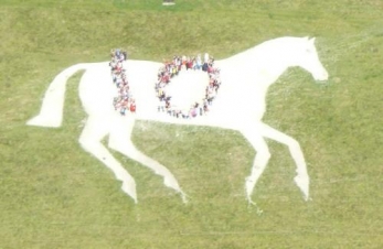
There is an excellent website called the White Horses of Wiltshire. There is a good discussion of the history of the Devizes Millennium White horse too.
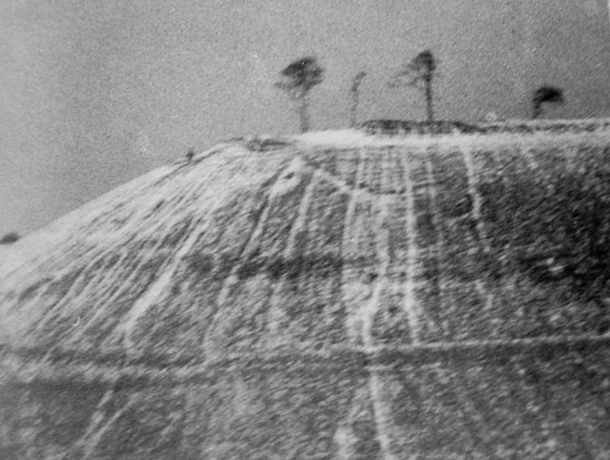
There was an old Horse - the Snobs' Horse built by Shoemakers' apprentices in 1845 on the east side of Oliver's castle. It has not been maintained and is now visble only in the right light and ground cover.
Right an old photo of the Snobs' Horse taken in winter.
